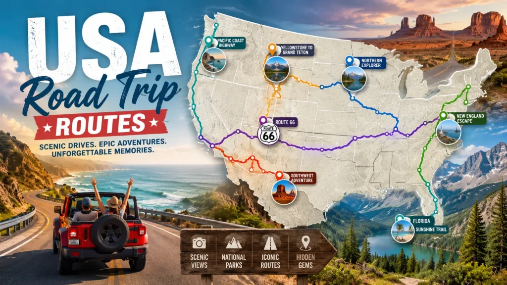
USA Road Trip Routes.The standard road trip playbook (looking at you, Route 66) is crowded, over polished, and frankly, a little predictable. You want the real America. The kind where diner owners know your name by the second cup of coffee, where cell service drops out just long enough to hear yourself think, and where the landscape feels like it belongs to you.
If you’re itching to trade bumper to bumper traffic for wild horses and neon lights for star filled skies, you’ve come to the right place. I’ve mapped out the USA road trip routes that the guidebooks miss. These are the hidden arteries of the country paths that lead to forgotten ghost towns, ancient petroglyphs, and swimming holes that taste like summer.
Why Ditch the Interstates for the Road Less Traveled?
Before we dive into the asphalt, let’s talk philosophy. USA Toad Trip Routes.The Interstate system is great for speed, but terrible for soul. When you stick to the highways, you miss the rusty water towers, the homemade pie stands, and the eccentric museums dedicated to things like barbed wire or lawn gnomes.
On these USA road trip routes, the detour is the destination. You drive slower, roll the windows down, and pull over for random historical markers just because. That’s where the magic lives.
The Loneliest Highway (Nevada’s Highway 50)
The Vibe: Utter solitude. High desert silence. Total freedom.
Most people think Las Vegas is the only reason to visit Nevada. They are wrong. Head east out of Carson City onto Highway 50, famously dubbed “The Loneliest Road in America.” Don’t let the name scare you; let it liberate you.
Why It’s a Hidden Gem
You won’t find traffic jams here. Instead, you’ll find the Sand Mountain Recreation Area a 600 foot singing sand dune that actually hums when the wind hits it right. Locals call it the “singing mountain.”
Must Stop Overlooks:
- The Shoe Tree (Middlegate): A juniper tree covered in hundreds of pairs of thrown shoes. No one knows who started it. It’s weird, wonderful, and pure Nevada.
- Hickison Petroglyph Recreation Area: A short, easy hike leading to ancient rock art carved by Native Americans 10,000 years ago. Zero entrance fee. Zero crowds.
Pro Tip: Stay overnight at the Middlegate Station. It’s a former Pony Express stop turned honky tonk bar. The burgers are greasy in the best way, and the jukebox only plays country.
Best time to go: Late September to October. The summer heat is brutal (over 100°F), but fall brings crisp air and golden light.
The Olympic Peninsula Loop
The Vibe: Mossy, moody, and prehistoric.
Forget the Pacific Coast Highway for a second. While everyone fights for parking in Big Sur, you could be driving through a temperate rainforest that gets 12 feet of rain a year. The Olympic Peninsula is a different world one where ferns grow bigger than minivans.
From Glaciers to Tide Pools
This loop starts and ends in Seattle, but the magic starts at Hurricane Ridge. One minute you’re in a pine forest; the next, you’re staring at snow-capped peaks that look like Switzerland.
The Must Do Detour:
- Hoh Rain Forest: Walk the Hall of Mosses trail. It’s only 0.8 miles, but you’ll feel like an extra in a dinosaur movie. The moss hangs so thick it looks like green fur.
- Ruby Beach: Unlike crowded California beaches, Ruby Beach is all about jagged sea stacks and driftwood logs worn smooth by the tide. Go at sunrise. You’ll have the whole place to yourself.
Practical Tip: You need a waterproof jacket. Not an umbrella the wind eats umbrellas here. Also, fill up your gas tank in Forks (yes, the Twilight town) before heading into the rainforest. Stations are rare.
Best time to go: July through September. The rains let up just enough to keep the trails muddy but not flooded.
The Great River Road (Wisconsin to Iowa)
The Vibe: Rustic, rolling hills, and “Driftless” weirdness.
Most folks blast through the Midwest on I-90, thinking it’s just corn. But hugging the Mississippi River on the Great River Road reveals a topography that defies geography. This area is called the “Driftless Zone” it was never flattened by glaciers, so you get steep bluffs, hidden valleys, and caves.
Small Towns with Big Character
- Stockholm, Wisconsin (Pop. 66): A tiny village of art galleries and pie shops. Order the sour cherry pie at the Stockholm Pie Company. Eat it on a dock overlooking the river.
- Pikes Peak State Park (Iowa): One of the best views of the Mississippi. In October, the fall colors reflect off the water like a painting.
- House on the Rock (near Dodgeville, WI): If you like the strange and unexplainable, this is a detour worth taking. An eccentric millionaire built a house literally hanging off a rock, then filled it with automated music machines and a giant squid fighting a whale. It defies description.
Pro Tip: Take the ferry across the river at Cassville, WI to Turkey River, IA. It saves two hours of driving and gives you a 10 minute boat ride for just $8.
Best time to go: October for fall colors, or May for blooming wildflowers.
The Blue Ridge Parkway (But Off the Overlooks)
The Vibe: Slow, misty, and musical.
Yes, the Blue Ridge Parkway is famous. But the famous part is the overcrowded section in Virginia. The hidden magic happens on the less-traveled southern end, dipping into North Carolina and Georgia.
How to Beat the Crowds Here
Don’t just stay on the Parkway. Use it as a spine, but explore the “spurs” into the backcountry.
Hidden Stops on this USA road trip route:
- Waterrock Knob: Skip the main visitors center. Drive to the very end of the service road for a 360 degree view that looks like a Bob Ross painting came to life.
- The Road to Nowhere (Bryson City): A mysterious, unfinished tunnel deep in the woods. It’s a paved road that just… ends. Locals say it’s haunted by the ghosts of a flooded town.
- Mountain Farm Museum (Oconaluftee): A free, outdoor collection of log cabins from the 1800s. No velvet ropes. You can walk inside and touch the hearths where families cooked dinner 150 years ago.
Practical Tip: Gas stations are few and far between on the southern parkway. Fill up in Cherokee, NC before heading toward Georgia. Also, watch for elk at dawn. They just stand in the road like they own the place.
Best time to go: June (rhododendrons are blooming) or late October (peak leaf season, but go mid week to avoid leaf peeping traffic).
The Trail of the Ancients (Utah/Colorado Border)
The Vibe: Mystical, red rock, and silent.
Moab is a zoo. Arches National Park requires a reservation just to breathe. If you want red rocks without the crowds, head to the southeastern corner of Utah where it meets Colorado. This is Ancestral Puebloan territory.
Ruins You Can Touch
- Hovenweep National Monument: Unlike crowded Mesa Verde, Hovenweep lets you see ancient towers perched on canyon rims. The Square Tower Loop hike is 2 miles. Bring twice as much water as you think you need.
- Canyon of the Ancients (Colorado): This is a “leave no trace” treasure. There are over 6,000 recorded archaeological sites here. Do not take artifacts, but do look for petroglyphs of spirals and sheep.
- Dove Creek Pottery: A tiny, family-run shop where a 70 year old potter shows you how to make traditional clay pots using the same methods as the Ancient Ones. It’s a hands on history lesson.
Warning: Cell service is non existent here. Download offline Google Maps. Also, beware of “high clearance” road signs. They mean it. Do not take a sedan down a washboard road unless you want to shake your teeth loose.
Best time to go: April May or September October. Winters are freezing; summers are deadly hot.
Essential Gear for Offbeat USA Road Trip Routes
You can’t just throw a duffel bag in the back for these drives. You need a survival mindset.
- A Physical Road Atlas: Your phone will die. GPS will lie. A $10 paper map never needs a charge.
- The “Just in Case” Cooler: Pack hard boiled eggs, cheese sticks, and sparkling water. In tiny towns, gas stations might close at 6 PM.
- Cash (Small Bills): The best pie stands and roadside fruit shacks don’t take credit cards.
- Audible Audiobooks: Podcasts are great, but a 400 page novel makes the empty horizons fly by. I recommend Lonesome Dove for desert driving or anything by Bill Bryson.
- Camera Glove: A thin glove for your left hand. Driving for 6 hours with your hand on a hot steering wheel in Utah is painful. A cheap golf glove saves the day.
How to Plan Your Own Unique USA Road Trip Route
Want to build your own hidden route? Here is my 3 step system.
- Open Google Maps in “Terrain” Mode. Look for green patches (forests) and squiggly lines (mountains). Those squiggly lines are the fun roads.
- Search for “Scenic Byways [State Name].” Every state has a tourism website listing their designated scenic roads. The more obscure the name, the better the road.
- Look for “Unimproved” Camping. If you see a brown sign that says “Dispersed Camping” or “Primitive Site,” turn in. Those are free campsites with no amenities, just stars and silence.
A quick reality check: Some of these roads are rough. You might get a flat tire. You might take a wrong turn and end up at a ranch. That’s the point. The best stories come from the moments you got slightly lost.
Conclusion & Call to Action
The interstate will still be there when you get back. But right now, those winding backroads are calling. Whether you chase the solitude of Nevada’s deserts, the mist of Olympic’s rainforests, or the ancient whispers of Utah’s towers, the USA is so much bigger than its postcards.
These USA road trip routes are waiting to show you the version of America that doesn’t make it onto Instagram Explore pages.
So, where are you heading first? Got a hidden route I missed? Drop your favorite offbeat driving tip in the comments below. And if this guide saved you from another boring highway, share it with a friend who needs an adventure.
Frequently Asked Questions (FAQs)
What is the best USA road trip route for a first time solo traveler?
The Great River Road (Wisconsin/Iowa) is the safest bet. It has small towns every 20-30 miles, solid cell coverage, and friendly locals. You get the beauty without the isolation of the desert routes.
How long do these USA road trip routes typically take?
To do them right? Plan 5-7 days for the Loneliest Highway or Olympic Loop. The Great River Road can be done in a long weekend (3-4 days). The Trail of the Ancients needs at least 4 days to hike the ruins properly.
Do I need a 4×4 vehicle for these hidden routes?
Generally, no for the main roads, but yes for the best detours. A standard sedan handles the Blue Ridge and Great River Road fine. You need high clearance (think Subaru Outback or Jeep) for the washboards on the Trail of the Ancients.
Which route is best in winter (December February)?
Only the Blue Ridge Parkway if the lower elevations (NC/GA) are snow-free, but it’s risky. Honestly? Save these for spring or fall. Most of these roads close or become dangerous with ice.
Are these routes dog friendly?
Absolutely. The Olympic Peninsula is a paradise for hiking with dogs (on leash). The Loneliest Highway is great because dogs can run at rest stops since no one is around. Always check state park rules first some don’t allow pets on trails.
What is the #1 hidden gem restaurant on any of these routes?
Middlegate Station (NV) on the Loneliest Highway. Order the “Monster Burger.” If you finish it, you get a t-shirt. The walls are covered in dollar bills signed by truckers from the 1980s.
How much cash should I carry?
Aim for $150-$200 in small bills ($5s and $10s). Many honor-system farm stands (leave money in a coffee can) are along the Great River Road and in Utah. ATMs are 80 miles apart in Nevada.
Which route is best for photography?
The Trail of the Ancients (Utah/CO). The golden hour light on red rock ruins is unlike anywhere on earth. Bring a tripod for Milky Way shots it’s a certified Dark Sky area.
Are there ghost towns on these routes?
Yes! On the Loneliest Highway, detour to Berlin Ichthyosaur State Park. It’s a preserved mining ghost town and a fossil site of giant prehistoric fish lizards. Two weird things for the price of one.
What is the biggest mistake people make on these trips?
Underestimating distance. On a map, 100 miles in Virginia takes 2 hours. 100 miles in rural Nevada or Utah takes 3.5 hours because of winding roads, construction, and stopping for cows in the road. Always add 30% more time than Google says.