
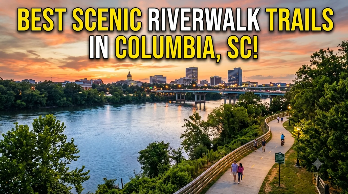
The Best Scenic Riverwalk Trails in Columbia, South Carolina 2026
Riverwalk Water. Columbia is a city that is absolutely centered around water. After all, right smack in the middle of the state’s capital city lie the confluence of three major South Carolina rivers-the Broad River, the Saluda River, and the Congaree River which have carved out a gorgeous natural playground of waterways for outdoor enthusiasts to enjoy.
The absolute best way to explore Columbia’s aqueous wonderland?
The city’s best scenic riverwalk trails! From paved paths to elevated boardwalks and tranquil greenways tracing the edge of the river to parks, wildlife sanctuaries, and historic markers, there’s something for every walker and nature lover to experience. If you’re a local looking for a new place to take the dog for a weekend walk or a visitor aiming to get an authentic experience of the city, join me on a virtual trip along every stretch of the Three Rivers Greenway, Columbia’s 15.5 mile public path. So let’s grab our walking shoes, a water bottle, and get moving!
What Is the Three Rivers Greenway?
Let’s put it all in perspective before we take on the individual trails. Three Rivers Greenway is a series of connected waterfront paths that meander through Columbia and our neighbors Cayce and West Columbia. More and more connected pathways, boardwalks, and green space appear as we continue connecting paths along the Broad River, the Saluda River, and the Congaree River. It’s our outdoor spine connecting you to paths where you can walk, run, bike, fish, watch the birds or just watch the water rush past.
The greenway is broken up into segments with separate personality’s and attractions.
Some are joined by pathways and other still needs paths to connect, but each has their own appeal. A special note: ADA accessible and equipped with lighting, signs, restrooms, picnic sites, call boxes and is safe, family friendly and perfect for all visiting ages!
Riverfront Park & Columbia Canal Trail The Historic Classic
Kicking it off with a timeless- the trail that paved the way! Opened in 1983, Riverfront Park has always held a special place in the heart of Columbia. Stretching between the Broad River and the old Columbia Canal, you’ll find 2.5-3 miles of beautiful, flat, shaded trail perfect for walking, running or biking.
What Makes It Special
Walk along 19th century towpath History permeates this trail: You are walking along the old towpath of the Columbia Canal that once transported products between upstream towns and the Fall Line towns. You’ll notice interpretive markers along the way explaining how the region developed historically as well as a hydraulic turbine house from 1890 and a pump house from 1924. Fun for kids: Find the “fish ladder” at the northern entrance (4122 River Dr.) which enables spawning fish to move upriver around the Columbia Diversion Dam.
Children are fascinated by fish jumping up the ladder-it is a nature documentary in progress.
Don’t miss: Kick back in the giant, cushy Adirondack chairs at the southern entrance (312 Laurel St.) with a view of the river as the sun sets.
Trail Details
- 5 mile out and back with 2.5 to 3 miles each direction •
- Surface is paved and relatively flat • ~ 3 4 2 2 R • ~ 4 1 2 2 3 l A 4 P,
- parking at both ends; public rest stops at both ends
Saluda Riverwalk Shaded Beauty & Boyd Island
If shade, peace, and a dose of adventure are what you’re after, the Saluda Riverwalk trail is the place for you. You’ll traverse three miles of lighted concrete trail interspersed with timber boardwalk along the Saluda River from I 26 to I 126.
What Makes It Special
Shady Escape: The Saluda Riverwalk This is arguably one of the most beautiful and shady portions of the greenway. Tall trees form a natural canopy, keeping it comfortable even on a blazing summer day in Columbia. This section of the greenway passes behind the Riverbanks Zoo & Garden, so don’t be surprised if you hear animal calls from beyond the fence (we’re talking tigers, people!).
Crown Jewel: For ultimate peace and tranquility, head south along the greenway to the 7 acre Sanctuary at Boyd Island.
It’s connected to the trail by a small bridge. Here you’ll find metal sculptures, picnic areas, and an observation deck that overlooks the river. Adventure Options: The Saluda River is popular with kayaking, tubing, and canoeing enthusiasts you’ll see plenty of folks starting their river journey here in the summertime.
Trail Details
Description. 650 Candi Ln, Columbia, SC 29210. Get Directions .
6:00 AM-9:00 PM Every day.
View photos. View a map of the trail, parking area and restrooms. 3.6 miles (3.1 miles if you do not do the loop on Boyd Island) Surface. Boardwalk; Paved; Special Features.
River; Parking.
650 Candi Ln, Columbia, SC 29210, USA. Access. Parking is at the main trail head located next to the bathrooms at 650 Candi Lane, Columbia, SC 29210.
The parking is free. Amenities. Main trail head has bathrooms.
Water shoes if you want to venture out on the large rocks lining the river can be nice and cool.
West Columbia Riverwalk Skyline Views & Modern Amenities
Cross the Gervais Street Bridge and follow west Columbia riverwalk a 1.1 mile walking trail paved under an overpass, canopied by trees that runs alongside the western bank of the river.
What Makes It Special
Best View in the Greenway System: This greenway has some of the greatest Columbia city views you will ever experience along the greenway system. Enjoy the fast-moving river waters and watch as you stroll the boardwalk toward downtown Columbia. Smart City: This trail has plenty of city comforts that makes it convenient to explore.
The trail features public, free WiFi, a bicycle service center, outdoor workout facilities, river access, public restrooms, a small Little Free Library, picnic tables and several wayside exhibits.
Summer Concerts: the West Columbia Riverwalk Amphitheater is a popular spot for outdoor, concerts and other events in the summer months.
Trail Details
Distance: 1.1 miles (connects to the full Cayce Riverwalk)
Surface: Elevated boardwalk and paved trail
Entry Points: 109 Alexander Rd., 212 Hudson St., 106 Oliver St., 310 Court St., 100 Riverside Dr.
Parking: Free, off-street parking at various entry points
Restrooms: ADA accessible facilities are available
Local Pro Tip: Try visiting in the spring as native flowers and trees burst into bloom and re decorate the trail for the season; fall’s scenery is also exceptional, with brilliant hues surrounding the river.
Cayce Riverwalk The Long Haul
Just south of West Columbia, the Cayce Riverwalk extends the trail system with about eight miles of asphalt-paved walking paths and elevated boardwalk structures lining the Congaree River. This is the longest continuous segment of greenway and it’s a popular spot for avid runners and walkers as well as cyclists.
What Makes It Special
With more than 46 acres of river park land, the Cayce Riverwalk was created to preserve and protect the river corridor. During your visit, you’ll travel through vibrant foliage, catch glimpses of local wildlife and see whimsical hand carved wooden animals as part of your walk.
Take a trip back in time: The trail links to the 12,000 Year History Park, where a new visitor center is on the horizon, and provides view points to former landmarks from the old colonial village of Cayce.
Good for families: The trail is ADA friendly, stroller friendly and the ideal setting for children to play and explore.
Trail Details
Length: ~8 miles (connects to West Columbia Riverwalk)
Surface: Paved trails, boardwalk
Access Point: 201 Naples Ave., Cayce, SC (close to Blossom Street Bridge)
Parking: Available at various access points
Restrooms: Available at H. Kelley Jones Park (1.7 miles in)
Local tip: You’ll need at least an hour to walk this bit, but you could actually spend a half day poking around every last alcove.
Timmerman Trail A Hidden Extension
Extension of the Cayce Riverwalksystem with a hidden appeal is Timmerman Trail, a less-frequented path that offers an escape from the hustle and bustle of more crowded waterways.
What Makes It Special
The Timmerman Trail winds through shaded forests and offers peaceful views of the Congaree River. It’s less developed than some of the other sections, which adds to its charm. Birdwatchers will love this spot keep an eye out for herons, hawks, and other river birds.
Trail Details
- Length: Varies (connects to Cayce Riverwalk)
- Surface: Paved
- Access: Via the Cayce Riverwalk access points
When to Visit the Riverwalk Trails
One of the best things about Columbia’s riverwalk trails is that they’re beautiful year-round. That said, some seasons offer a better experience than others.
| Season | Vibe | Best For |
| Spring | Mild temps, blooming flowers, lush greenery | Leisurely walks, photography, family outings |
| Summer | Warm but shaded trails provide relief | Early morning or evening walks, tubing, kayaking |
| Fall | Cool weather, vibrant foliage | Long walks, cycling, sunset views |
| Winter | Quiet, peaceful, fewer crowds | Solitary reflection, birdwatching |
Insider tip! Visit in the morning, while you’re likely to spot more of thepark’s fauna hawks, raccoons, lizards, and herons are most active. Sunset is also fantastic – you can enjoy gorgeous lighting and avoid most of the afternoon’s hustle.
What to Bring & Practical Tips
And one final to-do list to prepare you for a visit to the trails, which has a paved flat surface (which may still require the best walking shoes possible): bring along lots of water, sunscreen and hats as the sun will get intense even when the paths can be shady, and you may want to bring your camera, of course, but do not forget to bring some food as there will be places for picnics along the way.
Lastly, if you bring a dog with you, please keep it on its leash since these trails will allow you to be in close proximity to dogs that may have some animal behavior or even have dogs in an unventilated state. If there is a risk or an emergency along the trail system there will be security boxes as well as lights but the risk for personal safety in areas like the walking paths could pose risks to people when they are either alone or have not been advised regarding certain dangerous elements present in the paths.
Wildlife Spotting Along the Trails
Explore Riverfront Trails and Watch Wildlife Whether visiting during the day or by the light of the moon, keep your eyes peeled for: birds such as hawks, herons, owls, and woodpeckers; mammals like raccoons, squirrels and even deer; sunbathing reptiles and striped bass being pulled by lucky anglers from the Congaree River. Head out during the early morning or later afternoon for your best chance to see animals at their most active.
Beyond Walking Other Activities on the Riverwalk
Beyond the trails The riverwalks offer far more than just walking!: Biking: paved for bike trails throughout the entire stretch. Fishing:Striped bass and other types of fish swim throughout the Congaree River. Kayaking & tubing:The Saluda River is an ideal place for a paddle.
Birdwatching: Pack binoculars and watch out for the local species.
Picnicking:Many picnic spots along the trail provide tables and wonderful views. Photography:Photograph the city skyline, the turbulent rapids of the Congaree, and many animals!
My Personal Favorite Route
If I could choose one single route to tell you, this would be it: Start on the Saluda Riverwalk (650 Candi Ln) and hike south to Boyd Island. Do the circle loop of the island, enjoy all the art sculptures, see the observation deck and head back. Overall Distance: 3.5 miles.
Time: 1 to 1.5 hours at an easy stroll.
Why this trail: The best of all the worlds in terms of shade, water views, wildlife, bit of history and the enchantment of being on your own private little island! Parking is abundant, restrooms conveniently located right on the trail.
Summary
These Columbia riverwalk trails aren’t just paved paths; they’re a vital link to the soul of our city. Whether strolling the historic Columbia Canal, navigating the cool shade of the Saluda Riverwalk, admiring Columbia’s city views from West Columbia, or walking miles upon miles along Cayce Riverwalk, these are among the finest scenic riverwalk trails in Columbia, South Carolina. Accessible, safe for the whole family, and jaw droppingly pretty… and completely free of charge.
Free as in: zero admission cost.
Free as in: no permits needed. Free as in: no wallet required. Free as in: the whole damn thing is yours for the taking (and the loving).
Call to Action
Which riverwalk trails have you discovered already?
Which is your favourite or which would you love to try first? Let me know below!
Please share this guide with your friends too!
Happy walking!
Click For More : How to Find the Center of the Universe Acoustic Anomaly in Tulsa 2026
Frequently Asked Questions (FAQs)
Are the Columbia riverwalk trails free to access?
Yes! All sections of the Three Rivers Greenway are completely free to access. There are no entrance fees or permits required.
How long is the Three Rivers Greenway trail system?
The greenway currently spans approximately 15.5 miles and is still growing. Some sources list the total as 19.4 miles including all segments.
Are the trails dog friendly?
Yes, leashed dogs are welcome on all sections of the riverwalk.
Is the riverwalk accessible for strollers and wheelchairs?
Absolutely. All sections are ADA accessible with paved, flat surfaces and accessible entrances.
Where can I park for the Saluda Riverwalk?
The main parking area is at 650 Candi Ln., Columbia, SC 29210. Free parking is available near the restrooms.