Through the Rocky Mountains You sit in the driver seat, windows open, and the cool mountain breeze blows into the vehicle. The route is going uphill, and soon you reach a point where there are no more trees, only the endless views of granite mountains, snow fields, and a blue sky. This is how the drive through the Rocky Mountains is like. Through the Rocky Mountains
This kind of driving gives you the urge to stop at any outlook along the way since it is impossible to believe that the view from there is real. I must admit that I have traveled through these routes many times but still get amazed each time. Through the Rocky Mountains
To discover the best routes in the Rocky Mountains, you will need to do some research. Some are well known, located above the tree line. Others are narrow and winding, passing through the canyons, with old mines visible along the way. They all have one thing in common they are unforgettable. Through the Rocky Mountains
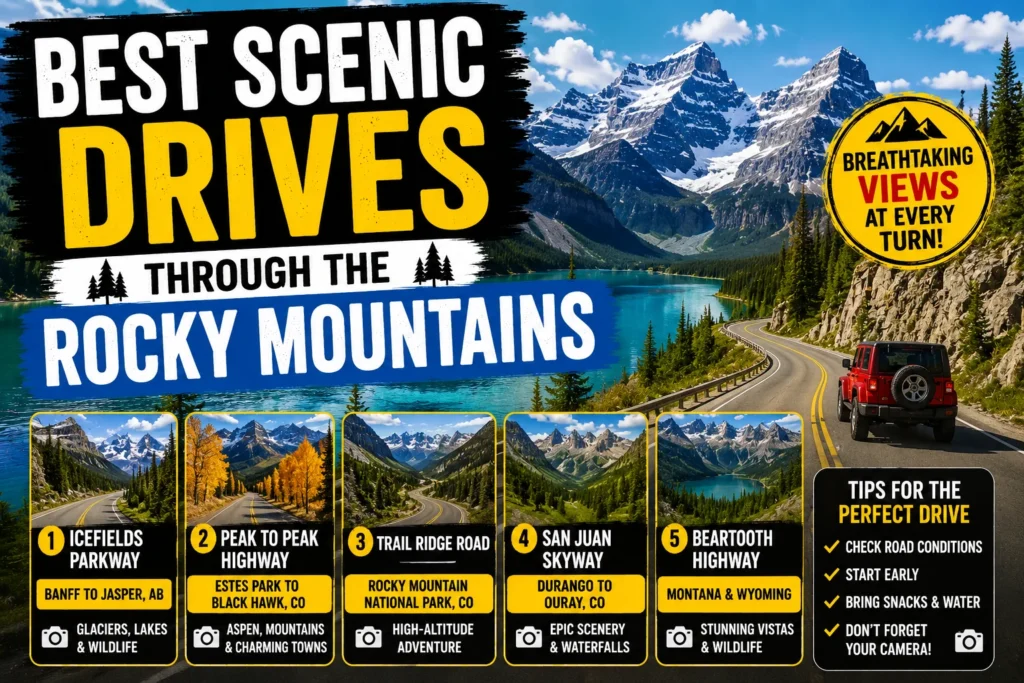
This guide includes all the information about the best Rocky Mountain scenic drives that you need to know. Through the Rocky Mountains
Trail Ridge Road, Rocky Mountain National Park Through the Rocky Mountains
Distance: 48 miles one way
Travel time: 1.5 to 2 hours without stopping (but allow 3 to 4)
Best Time to Visit: late May mid October Through the Rocky Mountains
The Atmosphere: Above the treeline, high in the clouds
This is the biggie. The Trail Ridge Road is the highest point to point paved highway in the United States, rising to an elevation of 12,183 feet above sea level. This scenic road links the towns of Estes Park, which lies on the eastern side of the park, and Grand Lake, found on its western end. Through the Rocky Mountains
What makes it unique: For a span of around 11 miles of the trail, you are above the treeline where alpine tundra lies all around you. At this altitude, you get panoramic vistas everywhere you look. On your right, rises the majestic Longs Peak, Colorado’s most recognizable peak. On your left are the Never Summer Mountains. Through the Rocky Mountains
Best views:
- The Gore Range Overlook (mile 19.3 from Estes Park): This spot sits near the crest of the road, offering long-range views west to the Never Summer Mountains and east to Longs Peak . Through the Rocky Mountains
- Alpine Visitor Center: Perched at 11,796 feet, this is the highest visitor center in the National Park Service . It is a great place to stretch your legs and see the view. Through the Rocky Mountains
- Rock Cut and Forest Canyon Overlook: Great places to walk a short section of the Tundra Communities Trail . Through the Rocky Mountains
Pro Tips: Reservations are necessary to enter Rocky Mountain National Park during the summer months. A timed entry permit is required to access all the locations within the park.
The road is a seasonal road. Typically, the road is open from late May through mid October. Snow conditions may vary and it is better to confirm the road condition before planning your trip. For road information, call the park’s recorded road status number: 970 586 1222.
Be prepared for cold weather. Even in July, it might be 20 to 30 degrees colder at the top than in Estes Park and Grand Lake, and the winds blow continuously. Layered clothing is recommended year round . Through the Rocky Mountains
Wildlife alert! Watch for elk, mule deer, and bighorn sheep along the road. Also, marmots and pikas can be seen close to the tundra.
Don’t bring pets. Animals are not allowed on any trails and on the tundra and meadows. Through the Rocky Mountains
San Juan Skyway, Southwest Colorado Through the Rocky Mountains
Length: 232 miles long round trip route
Drive time: 7 hours if driving non stop (it’s better to devote a whole day or more)
Ideal seasons: Summer and early fall (it’s plowed in the winter, but the weather is pretty severe then)
The atmosphere: Epic, historic and dramatic Through the Rocky Mountains
This is not a mere road it’s an adventure that will allow you to experience some of the most amazing mountain views across the USA. The San Juan Skyway has been recognized as an All American Road, as well as the National Forest Scenic Byway and the Colorado Scenic & Historic Byway. It is a round trip of 232 miles that goes through two national forests, crosses four mountain passes, and features 13 peaks above 14,000 feet . Through the Rocky Mountains
Why is it special? The most popular part of the trip on the San Juan Skyway is a drive on the Million Dollar Highway, which runs for 23 miles between two former mining towns of Silverton and Ouray. It is one of the finest examples of engineering solutions applied in the mountains, running along the edge of the Uncompahgre Gorge. Through the Rocky Mountains
Best views Through the Rocky Mountains
- Molas Pass (10,899 feet): Known for its clean mountain air and beautiful lakes . You might even see the Colorado Trail, which crosses the pass on its way to Denver . Through the Rocky Mountains
- Red Mountain Pass (11,075 feet): The heart of the Million Dollar Highway. The road climbs up past Red Mountain, a collapsed volcano cone that gets its name from the oxidized minerals on its surface . Through the Rocky Mountains
- Dallas Divide: A stretch near Ridgway with sweeping views of the San Juan Mountains and Mount Sneffels . Through the Rocky Mo
- This is a serious road. It is windy and steep. Take it slow and enjoy the view.
- Plan for a full day. The official drive time is seven hours without stops, and you will want to stop for photos and exploration .
- Fill up your gas tank. Gas stations are infrequent along the route, especially in the higher elevations .
- Start in any of the historic towns. The loop connects Durango, Silverton, Ouray, and Telluride . Each town is worth a visit and offers a glimpse into Colorado’s mining history.
- Check conditions. The Colorado Department of Transportation website will have the latest on road conditions .
Going to the Sun Road, Glacier National Park Through the Rocky Mountains
Length: 50 miles one way
Travel time: 2 to 3 hours with no rest
Best Season: Late June to Mid October
Overall Experience: Wild, remote, and breathtaking
When going on a scenic drive through the Rocky Mountains, there should be an inclusion of this. Going-to-the-Sun Road is the only highway in Glacier National Park that runs through the Continental Divide at Logan Pass. It has been named as a National Historic Landmark and is one of the most difficult highways to be snowplowed in the United States. Through the Rocky Mountains
Why it is unique: This road is noted for its tight and twisting layout, along with the steep and imposing “Garden Wall” cliff. It starts from the forests of the west valleys of Glacier Park and leads to the upper alpine area of the park giving a view of glaciers, valleys and mountain goats climbing the cliffs. Through the Rocky Mountains
Logan Pass (6,646 feet): Highest point on the road Through the Rocky Mountains.
The “Loop” and the Garden Wall: A hairpin turn, where you’ll get an incredible view of the famous sheer rock wall.
Many Glacier: A side trip which will give you some of the most impressive views in the park.
Vehicle Restrictions: No vehicle that is longer than 21 feet or wider than 8 feet may travel on the upper parts of the road.
Seasonal open time: The road opens around the first week of June, but the specific day varies depending on the success of the snow removal. Visit the park’s website to learn more information.
Timed entry reservation: A timed entry reservation to Glacier National Park must be made by everyone in summer.
Slow down: The speed limit in the winding and steep alpine areas is 25 miles per hour. Through the Rocky Mountains
Use the shuttle: You can use a free shuttle service provided by the park to enjoy the views without driving stress.
Click For More: How to Visit Clearwater Beach Florida on a Budget 2026
Beartooth Highway, Montana/Wyoming Through the Rocky Mountains
Length: 68 miles one way
Drive Time: 2+ hours without stops
Best Time to Go: Mid May mid October
The Vibe: A high altitude, wide open adventure
The Beartooth Highway, a section of U.S. Route 212 between Red Lodge, Montana, and Cooke City, Montana, is an All American Road that is often called “the most beautiful drive in America” . It is a dramatic climb to a plateau and an alpine wonderland of lakes, rock formations, and sheer cliffs. Through the Rocky Mountains
What makes it special: The road rises from 5,200 feet in Red Lodge to 10,947 feet at Beartooth Pass in just 12 miles . This rapid change in elevation produces a stunning change in landscape. The road crests at a high plateau that offers views of the Absaroka Beartooth Wilderness, one of the largest wilderness areas in the lower 48 states. Through the Rocky Mountains
Best views Through the Rocky Mountains
- Beartooth Pass (10,947 feet): The highest point on the highway, where you have a sweeping view of the surrounding peaks and lakes .
- The switchbacks: The road is a series of dramatic hairpin turns as it climbs to the top of the pass. You will get vertigo, but the view is worth it.
- The numerous lakes: The highway is dotted with alpine lakes, perfect for a picnic stop .
- Check for closures: Snow can cause the road to close at any time, even in summer .
- Winter comes early: The road typically closes around mid October .
- Beware of altitude: Altitude sickness is a real risk. Take it easy on the hike to the top and drink plenty of water .
- Take the Chief Joseph Scenic Byway: The Beartooth Highway connects to this other scenic road, which is also worth a drive .
- Watch for thunderstorms: The high elevation makes this area prone to severe afternoon thunderstorms in the summer. Plan your trip accordingly .
Old Fall River Road, Rocky Mountain National Park Through the Rocky Mountains
Length: 11 miles, one way
Drive time: 1 hour plus
Best time to go: summer and early fall
The feeling: Slow, scenic, and adventurous
For an alternative view of the same scenery, try this gravel one-way road. It is the oldest motor road through Rocky Mountain National Park, completed in 1920 for automobile access to the mountains of the park. Through the Rocky Mountains
What makes it unique: This road is a “motor nature trail”. It offers a slow, careful, and intimate drive through the mountains, at a speed of 15 mph and without guardrails. It winds along the side of the mountain, giving an up close look at the scenery not visible from the paved Trail Ridge Road.
Views worth seeing Through the Rocky Mountains
Views from Fall River Valley when ascending.
Feeling of history and adventure.
Gravel road: You should expect a gravel road that is narrow and winding. A normal car will be enough as long as you drive slowly.
One way: The road is one way so there is no fear of having cars coming your way in the narrow parts.
Final destination: It ends at Fall River Pass where it meets Trail Ridge Road near the Alpine Visitor Center.
Why These Drives Are the Best Through the Rocky Mountains
All of these roads have their fame for a reason. It is because they are not only roads but destinations on their own. They are the highest, the most scenic, and the most historic. All of these are located in the Rocky Mountains and all lead you somewhere where you can’t help but be humbled.
Conclusion
The Rocky Mountains are a place of immense grandeur and natural beauty. On each bend of the road, there is a new view to see. Driving in the Rocky Mountains is not just about getting from point A to point B. It’s about adventure and experiencing the heart of the American West. Through the Rocky Mountains
Choose one of the following routes. Make your plans. And experience what makes them some of the most scenic roads in the world.
Have you been on any of the following Rocky Mountain roads? Leave us a comment about your experience below. If you enjoyed this guide, then send it along to a friend who enjoys road trips.
Frequently Asked Questions (FAQs)
What is the highest paved road in the Rocky Mountains?
Trail Ridge Road in Rocky Mountain National Park is the highest continuous paved road in the United States, reaching an elevation of 12,183 feet .
When do scenic mountain roads open?
Most high elevation scenic roads, like Trail Ridge Road and the Beartooth Highway, open in late May and close around mid-October due to snow .
Do I need a reservation to drive Trail Ridge Road?
Yes, a timed-entry reservation is required to enter Rocky Mountain National Park during the summer season .
Are the scenic roads safe for nervous drivers?
The Million Dollar Highway and Going-to-the-Sun Road are narrow and winding with steep drop-offs. They can be nerve-wracking for some drivers. Trail Ridge Road and the Beartooth Highway, while high in elevation, are more gradual. Always drive cautiously.
Are there places to stop for food and gas on these drives?
Services are limited. The San Juan Skyway passes through towns like Durango and Silverton . Trail Ridge Road has the Alpine Visitor Center , and Going to the Sun Road has a few stops. The Beartooth Highway has fewer services . Fill up your tank before you go.
What is the Million Dollar Highway?
The Million Dollar Highway is the 23-mile stretch of the San Juan Skyway between Silverton and Ouray, Colorado . It is famous for its cliff-hugging route and lack of guardrails.