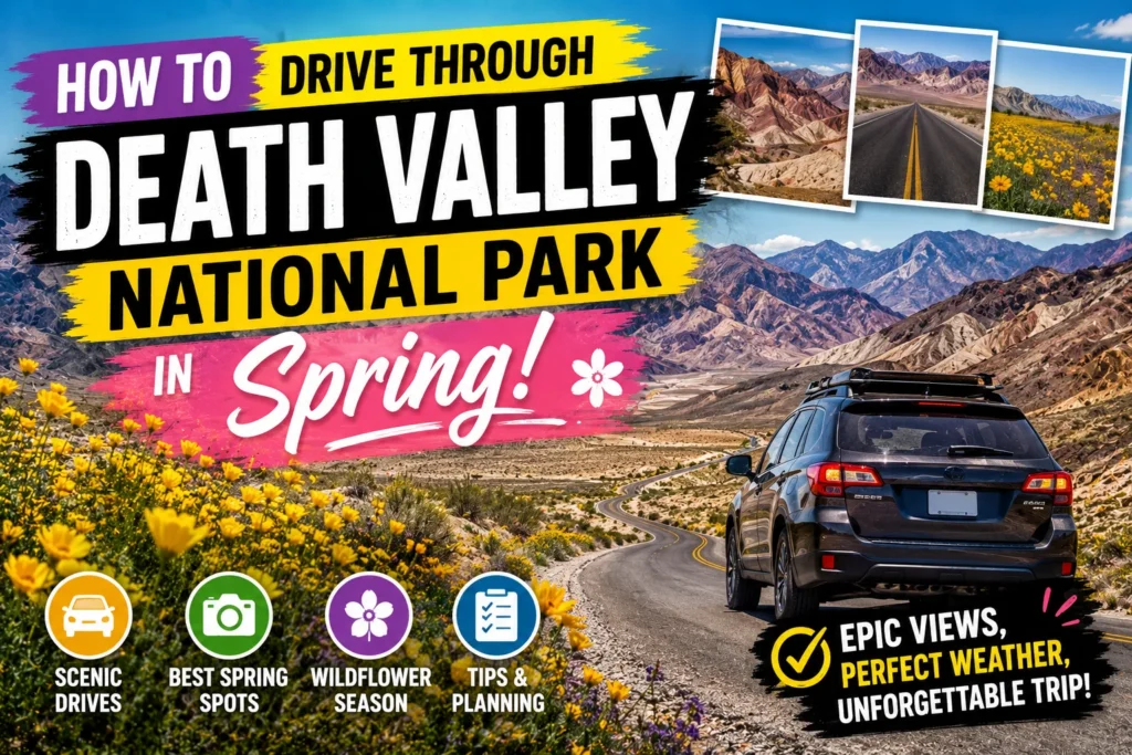
How to Drive Through Death Valley National Park. The road ahead shimmers. The mountains in the distance look fake, like a painted backdrop from an old Western. You roll down the window, and the dry heat rushes in not yet punishing, just present. A reminder that you are driving through one of the most extreme places on Earth.
Then you see them. Patches of gold and purple erupting from the desert floor. Wildflowers. In Death Valley. It feels like a miracle.
Spring is the Goldilocks season for visiting this legendary park. Not too hot. Not too crowded (well, compared to summer). And if the conditions align, you get a superbloom that turns the “hottest place on Earth” into a garden.
But driving through Death Valley requires planning. Serious planning. Gas stations are 50 miles apart. Cell service does not exist. And the difference between a great trip and a dangerous one is knowing exactly what you are doing.How to Drive Through Death Valley National Park
This guide covers everything you need to know about how to drive through Death Valley National Park in spring . Let us hit the road.
Why Spring is the Best Time to Drive Death Valley How to Drive Through Death Valley National Park
Most people think summer is Death Valley season. Those people have never been there in July (120°F feels like standing in a hairdryer).
Spring (How to Drive Through Death Valley National Park) is the sweet spot:
| Month | Avg High Temp | Avg Low Temp | Crowds | Wildflowers |
|---|---|---|---|---|
| March | 82°F | 55°F | Moderate | Possible (depends on rain) |
| April | 90°F | 64°F | High | Peak (if blooming) |
| May | 100°F | 73°F | Moderate | Dying off |
The magic window: Mid March to mid April. Temperatures are warm but not deadly. Daylight is long. And if winter rains were good, the desert explodes with color.
What about wildflowers? They do not bloom every year. You need a wet winter (at least 1.5 inches of rain between October and February). Check the park’s wildflower update on their website before you book. How to Drive Through Death Valley National Park
The Classic Death Valley Driving Loop How to Drive Through Death Valley National Park
This route hits all the must-see spots without backtracking. Perfect for a long weekend from Las Vegas (2 hours) or Los Angeles (4 hours).
Total drive time: 5 to 6 hours of actual driving (plus stops)
Total distance: ~150 miles inside the park
Starting point: Furnace Creek Visitor Center
The Southern Gems How to Drive Through Death Valley National Park
Morning: Enter from Death Valley Junction (Highway 190 east) or Baker (Highway 127 south).
Stop 1: Zabriskie Point
- Mileage: 5 miles from Furnace Creek
- Time needed: 30 minutes (walk the 0.3 mile paved path)
- Why stop: The classic Death Valley postcard. Golden badlands that look like rippled sand dunes made of rock.
Pro tip: Go at sunrise. The light turns the badlands into molten gold. Sunset is good too, but sunrise has fewer people.
Badwater Basin How to Drive Through Death Valley National Park
- Mileage: 17 miles south of Furnace Creek
- Time needed: 30 to 45 minutes
- Why stop: The lowest point in North America (282 feet below sea level). You walk out onto a massive salt flat that stretches to the horizon.
The feeling: It is eerily quiet. Your footsteps crunch on the salt. You feel very, very small.
Pro tip: Walk at least 0.5 miles from the parking lot. The salt polygons are more defined away from the crowds.
Stop 3: Artist’s Drive How to Drive Through Death Valley National Park
- Mileage: 9 mile one way loop (starts 1 mile south of Badwater turnoff)
- Time needed: 30 minutes (driving only)
- Why stop: A narrow, winding road through hills colored by oxidized metals (copper, iron, manganese). Purple, pink, green, and gold stripes.
The catch: The road is narrow, with tight turns. RVs and trailers are prohibited. Drive slowly.
Pro tip: Stop at the Artist’s Palette viewpoint (mile 5 of the loop). The colors are most vivid here.
Stop 4: Devil’s Golf Course How to Drive Through Death Valley National Park
- Mileage: 5 miles east from the Artist’s Drive exit
- Time needed: 15 minutes
- Why stop: A field of jagged salt spires so sharp that “only the devil could play golf here.” Walk a few feet onto the salt (carefully it cuts shoes).
Overnight: Stay in Furnace Creek or head to Stovepipe Wells (30 miles north).
The Northern Wonders How to Drive Through Death Valley National Park
Morning: Depart Furnace Creek heading north on Highway 190.
Stop 5: Mesquite Flat Sand Dunes
- Mileage: 30 miles north of Furnace Creek (near Stovepipe Wells)
- Time needed: 1 to 2 hours
- Why stop: The most accessible dunes in the park. Rolling sand hills that look like the Sahara.
What to do: Take off your shoes. Walk to the tallest dune (0.5 miles). Slide down. Take the classic “sunset silhouette” photo.
Pro tip: Go at sunrise or sunset. The shadows create dramatic lines. Midday is too bright and hot.
Stop 6: Mosaic Canyon How to Drive Through Death Valley National Park
- Mileage: 2 miles north of Stovepipe Wells (dirt road, accessible to most cars)
- Time needed: 1 to 1.5 hours
- Why stop: A narrow slot canyon with polished marble walls. You walk through a natural corridor carved by flash floods.
The hike: 2 miles out and back (easy, mostly flat). The canyon gets narrower as you go at the end, you are squeezing through walls inches apart. How to Drive Through Death Valley National Park
Pro tip: Go in the morning when the canyon is shaded. Afternoon sun makes it hot and bright.
Stop 7: Ubehebe Crater How to Drive Through Death Valley National Park
- Mileage: 55 miles north of Stovepipe Wells (via Scotty’s Castle Road watch for the washed-out section)
- Time needed: 1 hour
- Why stop: A massive volcanic crater (600 feet deep, 0.5 miles across). It was formed by a steam explosion 300 years ago.
What to do: Walk the rim trail (1.5 miles, easy). Or hike down to the floor (steep, loose gravel harder than it looks).
Road update: Scotty’s Castle Road has been closed due to flood damage. Check current status with the park. If closed, skip Ubehebe it is too long a detour. How to Drive Through Death Valley National Park
Alternative: If the road is closed, spend more time at the dunes or do the Salt Creek Interpretive Trail (see below).
Stop 8: Salt Creek Interpretive Trail
- Mileage: 13 miles north of Furnace Creek
- Time needed: 30 minutes
- Why stop: A boardwalk over a rare desert creek that hosts pupfish tiny fish that survive in water saltier than the ocean.
Best time: Spring (March to May) when the creek is flowing and the pupfish are active. Summer dries up. How to Drive Through Death Valley National Park
Check for more info: Top Day Hikes in North Cascades National Park Washington 2026
Spring Wildflowers Where to Find the Bloom How to Drive Through Death Valley National Park
If you hit the jackpot (a wet winter followed by warm spring), Death Valley transforms.
Best wildflower locations How to Drive Through Death Valley National Park
- Badwater Road (south of Furnace Creek) Desert gold and sand verbena
- Artist’s Drive Purple mat and brown-eyed evening primrose
- Greenwater Valley Road (unpaved, 4×4 recommended) Dense carpets of flowers
- Titus Canyon (4×4 required) A hidden canyon filled with blooms
Pro tip: Call the Wildflower Hotline at (760) 786 to 3200 (recorded message, updated weekly). Do not rely on social media conditions change fast.
Superbloom etiquette: Do not walk into the flowers. Stay on trails. One footprint can destroy years of growth. How to Drive Through Death Valley National Park
Essential Spring Driving Tips How to Drive Through Death Valley National Park
Gas is Scarce Plan Accordingly How to Drive Through Death Valley National Park
Gas stations inside the park:
- Furnace Creek (open 24/7, but pricey expect $2 to $3 more than outside)
- Stovepipe Wells (limited hours, call ahead)
- Panamint Springs (western edge of park)
The rule: Fill up every time you see a gas station. Do not let your tank drop below half. How to Drive Through Death Valley National Park
Distances between gas stations:
- Furnace Creek to Stovepipe Wells: 30 miles
- Stovepipe Wells to Panamint Springs: 35 miles
- Panamint Springs to the next gas (Olancha): 65 miles
Cell Service is Zero How to Drive Through Death Valley National Park
You will have no signal. Not “spotty.” Not “sometimes.” Zero.
What to do How to Drive Through Death Valley National Park
- Download offline Google Maps for the entire park
- Download offline maps on AllTrails or Gaia
- Tell someone your itinerary before you go
- Carry a paper map (the park gives you one at the entrance)
- How to Drive Through Death Valley National Park
Emergency: If you break down, stay with your car. A ranger patrols the main roads daily.
Water is Life How to Drive Through Death Valley National Park
Rule of thumb: 1 gallon per person per day. For a 3 day trip, bring 3 gallons per person.
Where to refill: Furnace Creek Visitor Center has potable water. No other locations are guaranteed.
Pro tip: Freeze a gallon jug overnight. It thaws slowly and gives you cold water all day.
Spring Weather is Unpredictable How to Drive Through Death Valley National Park
March can bring flash floods. Yes, in the desert. Rain in the mountains sends water rushing into the valleys.
What to do How to Drive Through Death Valley National Park
- Check the weather forecast daily
- Avoid driving through standing water (it may be deeper than it looks)
- Turn around if you see water flowing across the road seriously
- How to Drive Through Death Valley National Park
Sandstorms: Spring winds can kick up dust that reduces visibility to zero. Pull over, turn off lights (other drivers will follow your taillights), and wait it out. How to Drive Through Death Valley National Park
What to Pack for a Spring Drive How to Drive Through Death Valley National Park
Car essentials How to Drive Through Death Valley National Park
- Full size spare tire (not a donut)
- Jumper cables
- Extra coolant and oil
- Paper map
- Phone charger (car charger)
- How to Drive Through Death Valley National Park
Personal essentials How to Drive Through Death Valley National Park
- 1 gallon of water per person per day (minimum)
- Snacks that do not melt (nuts, dried fruit, granola bars)
- Sunscreen (SPF 50+, reapply every 2 hours)
- Wide-brimmed hat
- Sunglasses (polarized)
- Layers (mornings can be 50°F, afternoons 90°F)
- Headlamp (for sunset hikes)
- How to Drive Through Death Valley National Park
Nice to have How to Drive Through Death Valley National Park
- Cooler with ice packs
- Camp chair (for roadside picnics)
- Camera (you will take 500 photos)
- How to Drive Through Death Valley National Park
Where to Stay How to Drive Through Death Valley National Park
Furnace Creek Resort How to Drive Through Death Valley National Park
Cost: $250 to $450/night
Vibe: Historic, charming, central
The only “full service” lodging in the park. Two options How to Drive Through Death Valley National Park:
- Inn at Death Valley (fancy, $400+)
- Ranch at Death Valley (motel style, $250+)
Pro tip: Book 6+ months in advance. Spring weekends sell out by January.
Stovepipe Wells Village
Cost: $150 to $200/night
Vibe: Basic, motel, close to dunes
Smaller, cheaper, and closer to the sand dunes. The restaurant is decent. The pool is refreshing.
Camping How to Drive Through Death Valley National Park
Campgrounds How to Drive Through Death Valley National Park
- Furnace Creek Campground ($18/night, reservations open 2 weeks in advance)
- Sunset Campground ($16/night, firstcome)
Backcountry camping: Free, but you need a permit (from the visitor center). Must camp 1 mile from paved roads and 200 feet from water sources. How to Drive Through Death Valley National Park
Pro tip: Spring nights can drop to 40°F. Bring a warm sleeping bag.
What to Skip How to Drive Through Death Valley National Park
- Scotty’s Castle: Closed indefinitely (flood damage in 2015). Do not drive there.
- Racetrack Playa: The “sailing stones” are famous, but the road is 27 miles of rough dirt (4×4 required, 3 hours round trip). Skip unless you have a high-clearance vehicle and a spare tire.
- Dante’s View: Gorgeous view, but the road is steep and winding. Fine for most cars, but skip if you are nervous with heights.
- How to Drive Through Death Valley National Park
A Perfect 2 Day Spring Driving Itinerary How to Drive Through Death Valley National Park
Day 1 (How to Drive Through Death Valley National Park
- 8 AM: Enter park from Death Valley Junction (Highway 190)
- 9 AM: Zabriskie Point (sun is high enough for good light)
- 10 AM: Furnace Creek Visitor Center (get map, ask about road conditions)
- 11 AM: Badwater Basin (walk the salt flats)
- 12:30 PM: Lunch at Furnace Creek (packed picnic)
- 2 PM: Artist’s Drive loop (take your time)
- 3:30 PM: Devil’s Golf Course (quick stop)
- 5 PM: Check into lodging (Furnace Creek or Stovepipe Wells)
- 6:30 PM: Sunset at Zabriskie Point (different light than morning)
Day 2 How to Drive Through Death Valley National Park
- 7 AM: Mesquite Flat Sand Dunes (morning light)
- 9 AM: Mosaic Canyon (cool temps, shaded)
- 11 AM: Salt Creek Interpretive Trail (pupfish active)
- 12:30 PM: Lunch at Stovepipe Wells saloon
- 2 PM: Ubehebe Crater (if road is open)
- 4 PM: Start heading out (west toward Panamint Springs or east back to Vegas)
Conclusion
Death Valley is not a place to wing it. The beauty comes with risk extreme heat, no cell service, long distances between services. But if you plan ahead, respect the environment, and drive smart, you will experience something unforgettable. How to Drive Through Death Valley National Park
The colors of Artist’s Drive. The silence of Badwater Basin. The roar of the wind over the sand dunes. And maybe, if you are lucky, a carpet of wildflowers where you least expect them.
Spring is the season when Death Valley feels alive. Do not wait until summer. Go now. How to Drive Through Death Valley National Park.
Driven through Death Valley in spring? Drop your favorite memory in the comments. And if this guide helped, share it with a road trip buddy who needs to see the lowest point in North America.
Frequently Asked Questions (FAQs)
Is spring a good time to visit Death Valley?
The best time. March and April offer warm days (75 TO 90°F) and cool nights (50 to 65°F). Wildflowers may bloom. Summer is dangerously hot.
Do I need a 4×4 to drive through Death Valley?
No. The main roads (Highway 190, Badwater Road, Artist’s Drive) are paved and fine for any car. Some side attractions (Racetrack Playa, Titus Canyon) require 4×4 skip those.
How many days do I need in Death Valley?
2 days minimum. 3 days is perfect. One day for the southern route (Badwater, Artist’s Drive), one day for the northern route (dunes, canyon), and a third for hiking or a longer drive.
Can I drive through Death Valley in one day?
Yes, but you will rush. Enter from Las Vegas (2 hours), drive the main loop (5–6 hours of driving), exit toward Lone Pine (3 hours). You will see the highlights but miss the magic.
Is there cell service in Death Valley?
No. Zero. Download offline maps and tell someone your plans before you go.
Where do I get gas in Death Valley?
Furnace Creek (24/7, expensive), Stovepipe Wells (limited hours), Panamint Springs (western edge). Fill up at every opportunity.